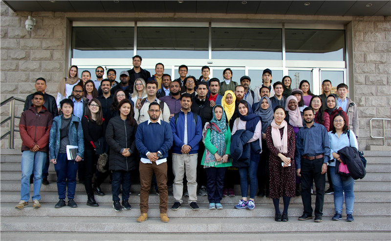
On March 14, the Centre organized a technical visit to National Disaster Reduction Center of China (NDRCC). Participants from 2018 MASTA & DOCSTA Program enjoyed this technical visit, and wrote about this meaningful and interesting visit:

“In the first session Dr. Ming Liu presented the Application of Space Technologies in Disaster Management in China, in which he explained the need of disaster management. According to the statistics of 2018, around 130 million People were affected, 635 People were dead or missing and disasters account for 264 Billion RMB worth of economic loss. He explained the dependence of Remote Sensing on Disaster Risk Monitoring and Emergency Monitoring, showed some real life examples of how the center use Satellite Imaginary to calculate the risk of disaster and damage assessment and explained the nature of images required for monitoring different catastrophe like flood, drought or typhoon. The center not only provide the services to the China but also provided services to different country having catastrophic event. He also showed the contribution of center in providing services during Dam collapse in Lao Po, Tsunami in Indonesia and drought in Afghanistan.
After the session, Dr. Ming Liu showed the BeiDou based disaster reporting system. The system uses the BeiDou system to receive the update on disaster. Since in emergency or catastrophe the traditional communication system like internet and cellular are prone to fail, the satellite based communication is the most reliable. They are continuously monitoring the status of each terminal placed all over the country from the center. As soon as disaster occurs the terminal sends the data and measures can be taken accordingly.
In third session, the participants visited the Disaster Monitoring Station. The official explained them about how they monitor the disasters, measures the intensity and calculate the amount of loss. The system can monitor multiple catastrophic event at a time.
The last session was quite interesting for the participants, the participant visited the 3D Mapping Lab, the lab uses the simple images from Unmanned Aerial Vehicles flying in catastrophic areas. These images later than processed and used to make a 3D image of the area. This kind of technique not only provide easy access in isolated areas but also be very useful in analyzing the precise condition of the area.”
——MUHAMMAD HARIS, 2018DOCSTA participant
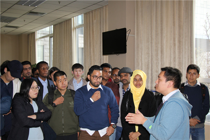


“On reception, students were introduced about the services and work carried out in MEM and its National Disaster Reduction Centre of China (NDRCC) by Expert Dr. Li Suju. NDRCC is an agency providing information and technological support, including a national disaster database which local civil affairs departments access to enter details about the disaster. She explained disasters are a challenge and how space technology is used in Disaster Risk Management. How Space Technology is best for international cooperation because space does not have any boundary.
NDRCC is a very strong supporter of the UN-SPIDER programme and is hosting the UN-SPIDER Beijing Office. UN-SPIDER facilitates fast and efficient access to space-based information for countries as well as international and regional organizations. This includes all types of information provided by Earth observation satellites, communication satellites and global navigation satellite systems.
Dr. Ming Liu, Expert of Remote Sensing (RS) & Forest Fire, presented MEM institutional reforms (support to other ministries and departments), services and products at national and international level in detail and how China has faced natural disaster. Use of RS Satellite Images in Disaster Management (Tsunami, Typhoon, Flood, Volcanic Eruption, Earthquake, Forest Fire, Landslide, Avalanche, Dust Storm, Drought), various types of RS data and their suitability for each state of disaster, spatial resolution and revisit relationship was explained. MEM not only utilizes national satellites products as FY, GF, & HJ, but also brings into free available products of satellites like MODIS, NOAA and Sentinel. How use of other indicators with satellite products can provide true results and risk monitoring is performed before emergency management by uses archival data, situation assessment, relief work and at last stage how recovery and relief monitoring is carried out were parts of the presentation. His presentation was concluded with International Products Service as disasters too do not have boundaries.
After presentation, students were taken to BeiDou Navigation Satellite System (BDS) lab. In this lab, use of BDS in disasters was explained. In disaster-stricken areas, most of the time ground to ground communication e.g. Internet, landline and cellular services get down. It nearly becomes impossible to communicate and with BDS supports, reports in the field can send location and text message by using built-in Short Message Service in terminals. Reported data is displayed on map-based application and by analyzing reported data rescue and relief activities are carried out. Other than terminals, an app is also developed for disaster reporters’ smart phones to report data.
Next lab to visit was Disaster Reporting System lab. Here information about disasters is collected at levels from a village to all country, from a family to all people. Based on this information, human and economic loss is estimated.
Another innovative and interested lab to visit was about Unmanned Aerial Vehicle (UAV) RS System lab. Scale and detail of work of this system was appreciable. Pre and post disaster 3-dimensional (3D) RS data of disaster-stricken places is acquired here and their 3D models are compared to see the change. Building points at national level are available in the system and based on devised algorithms, vulnerability and risk exposure of buildings in terms of counts is estimated here.
This informative and interesting visit concluded with visit to Real-time Satellites Orbiting Simulation System and group photo with MEM experts.”
—— HASSAN ALI, 2018 MASTA participant